Backcountry Books
Queyras Map | Brianconnais Queyras Top 75 Hiking Map
Queyras Map | Brianconnais Queyras Top 75 Hiking Map
Couldn't load pickup availability
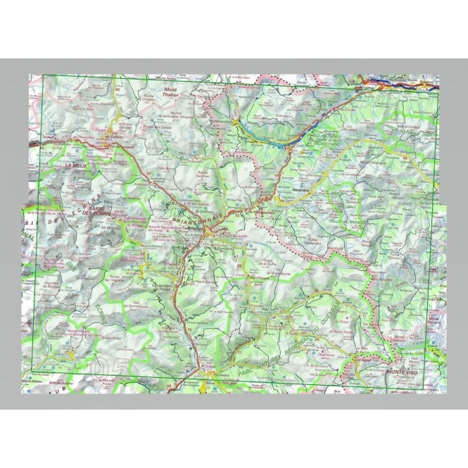
Queyras Map Brianconnais Queyras Top 75 Hiking Map is a 1:75,000 scale hiking map for the Briancon and Queyras region of the French Alps.
Brianconnais - Queyras PNR region in a series of GPS compatible, contoured TOP 75 maps at 1:75,000 from the IGN, highlighting local and long-distance hiking paths, cycling routes and sites for other recreational activities. The map includes five large panels showing the areas around Col des Ayes, Lac de l'Ascension, Riche Gauthier, Pointe de la Selle and Col de l'Eychauda on IGNs topographic mapping at 1:25,000 with extensive overprint for local hiking paths and tourist facilities including campsites.
Coverage of the main map starts just north of Mont Thabor and extends west to La Grave to include most of the Massif des Ecrins, with La Meije, Barre des Ecrins and Mont Pelvoux. The eastern part of the Parc Naturel Regional du Queyras and Monte Viso are shown on an inset.
Share