Backcountry Books
Regular price
£15.49 GBP
Regular price
Sale price
£15.49 GBP
Unit price
/
per
Taxes included.
Couldn't load pickup availability
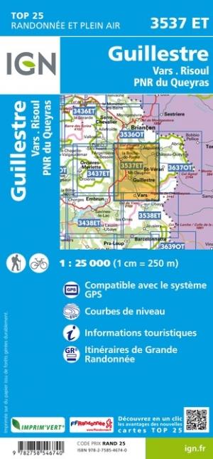
Queyras Map IGN 3537 ET Guillestre / Vars / Risoul / PNR du Queyras is a map of the Queyras region of the French Alps
15% discount when you buy 2 or more IGN maps with code IGN15.
IGN 3537 ET is a great ski touring, hiking and climbing map for the Queyras region of the French Alps.
IGN maps have great accuracy and detail. The 1:25,000 scale is perfect for all outdoor sports.
- 1:25,000 scale
- Perfect Guillestre area ski touring map and hiking map
Share
View full details