Backcountry Books
Backcountry Ski Map: Loveland Pass, Colorado | Beacon Guidebooks
Backcountry Ski Map: Loveland Pass, Colorado | Beacon Guidebooks
Couldn't load pickup availability
Backcountry Ski Map: Loveland Pass, Colorado is a ski touring, splitboarding and off piste map to Loveland Pass, Colorado by Beacon Guidebooks.
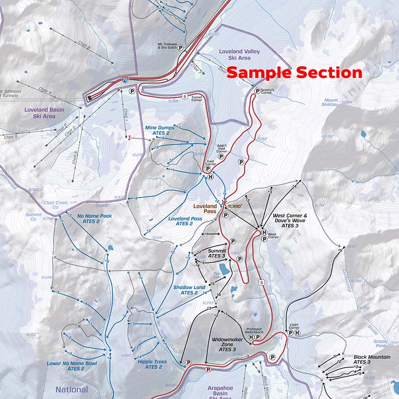
From Watrous Gulch to Porcupine Peak, from mellow glades to crazy couloirs, over 100 routes for this legendary zone along the Continental Divide are drawn in detail on this waterproof, foldable, topographic map. Tack it on your wall, or put it in your pack. No batteries required!
Welcome to the epicenter of backcountry skiing and snowboarding on Colorado’s Front Range. With over two decades of experience, Rob Writz, author and founder of Front Range Ski Mountaineering (frontrangeskimo.com), has delivered a ski map that is accessible to every type of skier for one of the most iconic backcountry zones in Colorado.
Written and reviewed by professionals, this 1:26,000 scale topo map details ski descents and uptracks, trailheads & parking information, resort boundaries, slope angles, Avalanche Terrain Exposure Scale ratings and so much more. Designed to go along with you on your tours and accompany the Backcountry Skiing Loveland Pass Ski Atlas and Ski App.
This 18” x 22” waterproof, foldable topo map includes the following zones: Watrous Gulch, Herman Gulch North, Mount Bethel Saddle, Upper & Lower Dry Gulch, Mount Trelease, Mine Dumps, Loveland Pass Bowl, Summit, Widowmaker, Shadowland, Hippie Trees, No Name Peak, Lower No Name Bowl, Porcupine Gulch, West Corner, Dave’s Wave, Black Mountain, Marjorie Bowl, and Porcupine Peak.
WATERPROOF | TEARPROOF | 1.5 OUNCES | 4″ X 5.5″ (folded) | 18″ x 22″ (open)
Please note - all Beacon Guidebooks are dispatched direct from Beacon in the U.S.A. Therefore they may arrive separately to other items on an order that contains multiple items.
Share