Backcountry Books
Freeride Map Les Arcs
Freeride Map Les Arcs
Couldn't load pickup availability
Freeride Map Les Arcs highlights the freeride descents both in the resort of Les Arcs and in the nearby backcountry. Les Arcs is a huge area that has fantastic freeride terrain both close to the pistes and in the nearby backcountry. Les Arcs is linked to the resort of La Plagne. View Freeride Map La Plagne here.
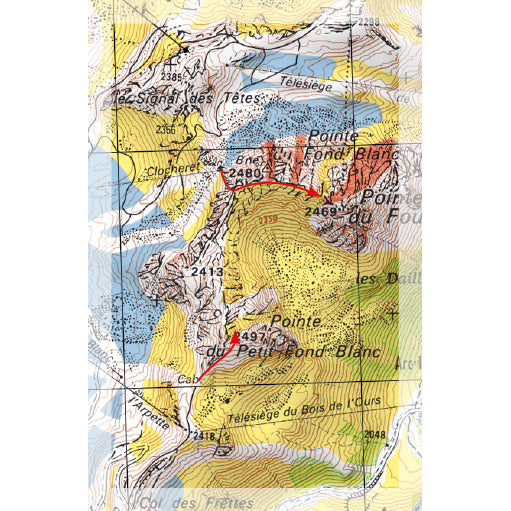
Freeride Maps are an awesome tool for the freeride skier or snowboarder to have in the mountains. Using highly detailed 1:25,000 scale maps as a base, Freeride Maps show popular freeride routes in some of the best areas in the Alps by the use of colour coded overlays. Blue, yellow and red overlays denote the route’s difficulty level. Zones that are particularly prone to avalanche are also highlighted, as are areas protected for wildlife.
Freeride Maps also have a huge amount of general information regarding basic avalanche and mountain safety protocol, along with specific information pertinent to the the local area. Although we regard Freeride Maps are a really useful tool for the freerider, they do not replace knowledge and experience. If in doubt, hire a local mountain guide.
- DEAL - Buy 2 maps, get a 3rd map at 50% off on all Freeride Maps (discount calculated at checkout)
- Colour coded freeride routes in and around the French mega resort of Les Arcs
- 3 different colours denote seriousness and difficulty
- Areas particularly prone to avalanche marked
- Wildlife only zones marked
- Weatherproof material
- 1:25,000 map scale is very detailed
- General avalanche and mountain safety info on rear of map
- Local area weather / avalanche / safety info also provided
- Secure checkout with debit / credit card or PayPal
- We ship worldwide!
Share